624 acres, one map
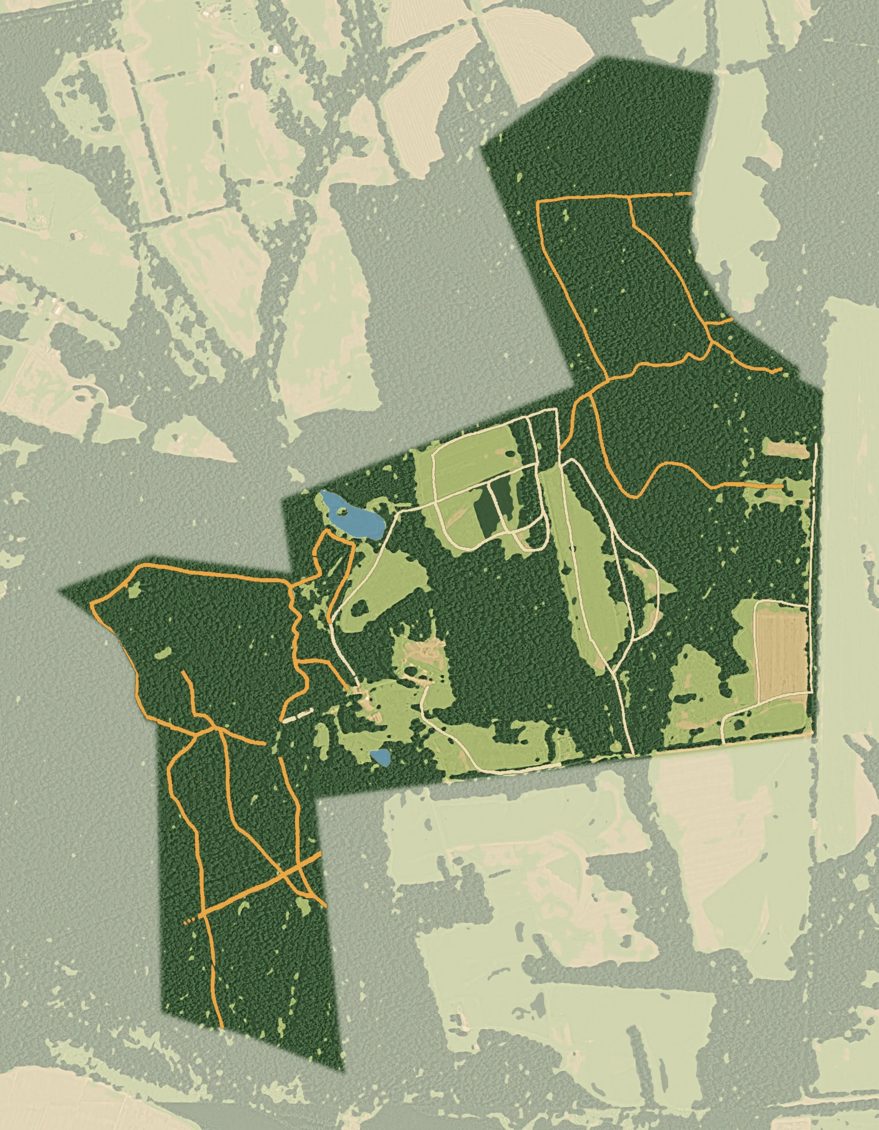
Every place on the map is a live record. Ranges show whether they're open and take reservations. Everything else has a page of its own.
Pick a place on the map
Every pin is a live record. Ranges show whether they're open and take reservations. Every other place has a page of its own.
Key
Painted from satellite imagery of the grounds. Trails, farm roads and place names follow the chapter's own trail map. The dashed line is the property line, from Maryland's parcel records.
Ranges
- Rifle & Pistol Range
Covered shooting stations for members and their escorted guests. One of only three public outdoor ranges in Montgomery County.
- Shotgun Range
Trap, skeet, wobble trap, sporting clays and five-stand, shot in groups with members rotating through stations.
- Archery Range
A field range with fixed targets from 20 to 80 yards, and 3D courses through the Archery Woods.
Buildings & camping
- Chapter House
The heart of the property: dinner meetings, board sessions, youth programs and workshops.
- Log Cabin
A historic cabin by the Small Pond, a short hike from the Chapter House. Perfect for families and dogs.
- Big Pond Pavilion
A rustic 12 by 16 foot shelter on the shore of the Big Pond, built by volunteers in 2019.
- Campground
Primitive walk-in tent camping under heavy tree canopy, with three sites: Ivy, Foxtrot and Cedar.
Ponds, trails & woods
- Big Pond
More than two acres, beyond the Cathedral of the Pines. The main destination for anglers.
- Small Pond
Beside the Log Cabin, and traditionally reserved for younger members.
- Fitzwater Nature Trail
The Joseph Fitzwater Conservation Nature Trail: a 0.8 mile interpretive loop near the Chapter House.
- Cathedral of the Pines
A stand of tall pines on the way from the Chapter House to the Big Pond.
- West Woods
Forest trails, game trails and four managed clearings, kept for native wildlife and plants.
- North East Woods
A 1.5 mile loop through the chapter's northeast forest, past an old homestead site.
- Shale Barrens
The B-CC River Road Shale Barrens Conservation Area, along the southern edge of the West Woods.
Fields & clearings
- B4 Field
One of the chapter's farm fields, with heritage corn.
- B3 Field
A long field between the woods, known for its sunflowers.
- C2 Field
The field between the Big Pond road and the Chapter House.
- C1 Field
The field along Izaak Walton Way, near the archery range and garden plots.
- B2 Field
A field east of the B3 Field.
- A1 Field
A field off Izaak Walton Way near Gate D.
- A2 Field
A field along the east side, reached from the A3 Field parking.
- Clearing A
A managed clearing in the West Woods. Good for seeing owls and deer.
- Clearing C
A clearing planted with milkweed for butterflies, especially monarchs.
- Garden Plots
Members' garden plots beside the archery range.
Parking
- Chapter House lot
A gravel lot at the end of the paved driveway, with three trailheads nearby.
- Gate E parking
Off-road parking in the south part of the A3 Field, for the campground and trails beyond.